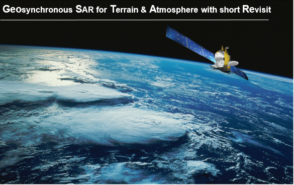
GeoSTARe in a mission combining the continuous view capabilities with super-continental access of geostationary orbits with the all-day-all weather imaging capabilities of Synthetic Aperture Radar, leading to a novel and unique observation system with quasi-continuous revisit. 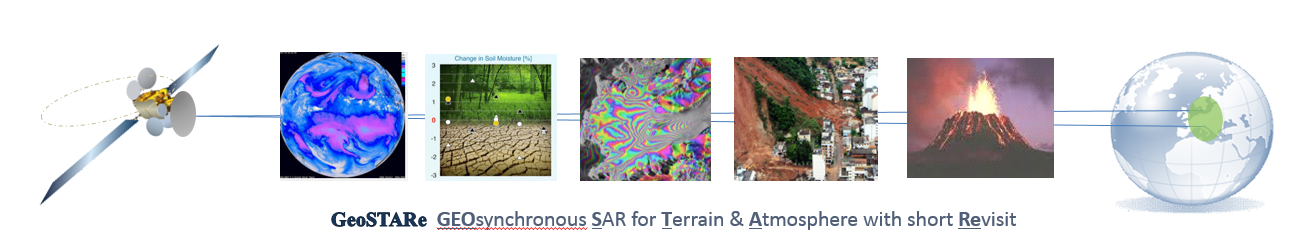
The well proven potentials of Radarin sensing roughness, deformations, and moisture makes of GeoSTARe a game changer in those fields, where hourly monitoring is a must – no other system can currently achieve GeoSTARe imaging capabilities.
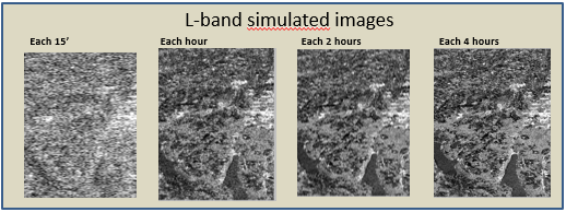
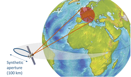
A C band payload on a telecom satellite would generate 150 m resolution images after 30 minutes, and the 10 m full resolution image by integrating data during an ~8 hours long aperture synthesis.
The quasi-continuous imaging enables a raft of applications for security, services and science addressing meteorology, cryosphere, seismology, geo-hazards, floods, agriculture, structural monitoring, emergencies.
Example of applications:
Generate water vapor maps with regonal coverage from SAR Inteferometry (each 15′ minutes, resolution 1 × 1 km), 
soil moisture maps for Numerical Weather Forecast.
Measure rapidly developing surface events such as river floods, landslides, earthquake damage and lava flows.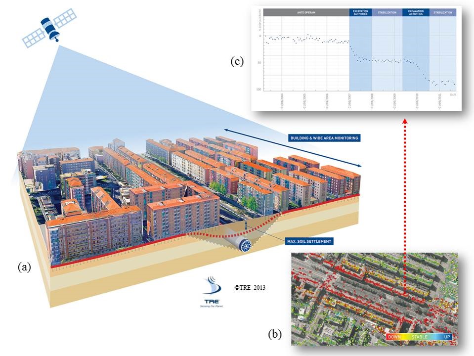
Monitor structures stabilities, like dam, mines, urban sites.
with subdaily updates, from a regional size down to local scale.
Concept and performances
The system can be implemented in different concepts: single, multiple or flexible beamwidth, C or L+X band, hosted pyaload on telecommunication satellite or stand alone-ministatellite.
It is scalable allowing for trading coverage, resolution, image time and revisit with cost. 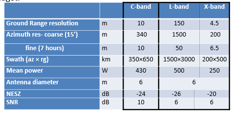
Way forward
GeoSTARe can evolve into a swarm of mini-satellites with a gain in revisit and power proportional up to the square of the number of sensors. A two-satellite swarm would achieve image revisit of one hour with a single look resolution of 30 × 10 m. The constellation operation is shown in the animation: SAR-satellites 1 and 2 are marked by dark stars, the red dot is a virtual third SAR created by transmitting with sat 1 and receiving sith sat 2. The black segment is the synthetic aperture in 1 hour of orbit, the blue one is the total aperture.
GeoSTARe is under study by a international consortium of miore than forthy scientists, it will be proposed as next ESA Earth Explorer IX – http://explorercall.esa.int/index.php/15-mission-ee9
References
Manzoni M, Monti Guarnieri A, Realini E, Venuti G (2020) Joint Exploitation of SAR and GNSS for Atmospheric Phase Screens Retrieval Aimed at Numerical Weather Prediction Model Ingestion, Remote Sens., 12, 654
Ruiz Rodon, J.; Broquetas, A.; Monti Guarnieri, A.; Rocca, F., “Geosynchronous SAR Focusing With Atmospheric Phase Screen Retrieval and Compensation,” inGeoscience and Remote Sensing, IEEE Transactions on , vol.51, no.8, pp.4397-4404, Aug. 2013
Wadge, G.; Guarnieri, A.M.; Hobbs, S.E.; Schultz, D., “Potential atmospheric and terrestrial applications of a geosynchronous radar,” in Geoscience and Remote Sensing Symposium (IGARSS), 2014 IEEE International , vol., no., pp.946-949, 13-18 July 2014
SES – Contract report “Study on the Utilisation of Future Telecom Satellites for Earth Observation” ESA Estec contract no 4000108594/13/NL/CT. Version 1.1
A. Monti Guarnieri, O. Bombaci, T.F. Catalano, C. Germani, C. Koppel, F. Rocca, G. Wadge, ARGOS: A fractioned geosynchronous SAR, Acta Astronautica, Available online 2 December 2015, ISSN 0094-5765, http://dx.doi.org/10.1016/j.actaastro.2015.11.022.