The definition of a unique vertical datum is nowadays a fundamental problem in geodesy and in many geophysical disciplines. In principle the definition of a global geoid, namely the choice of an equipotential surface of the Earth gravity potential, as a reference for the heights is a direct solution to the problem. However, since the geoid is practically materialised by tide gauge observations, which are affected by steady (coastal) currents, there are significant discrepancies between height datums of different countries.
The availability of satellite global gravity models, like GOCE, have re-opened this problem offering the possibility of its solution.
GEOlab in cooperation with the International Service of the Geoid (ISG) and within the Global Geodetic Observation System (GGOS) project has defined a strategy for the unification of the height datum, based on satellite-only global gravity models, GNSS/levelling data over lands and MDT models over seas.
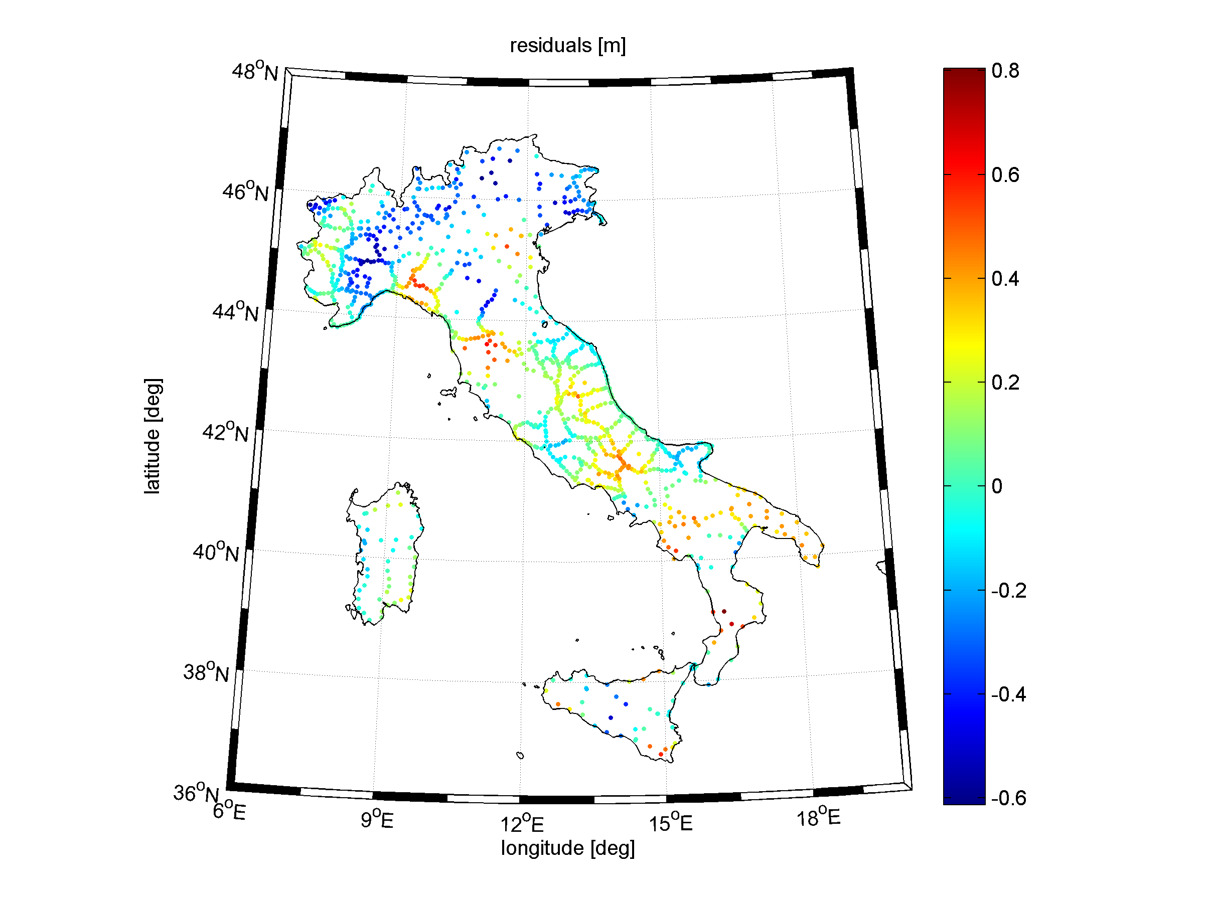
The strategy has been applied at a global scale by performing an error budget simulation (Gatti et al., 2012), and implemented at a local scale (Barzaghi et al., 2015) to find a preliminary solution to the Italian height datum unification (at the moment the mainland, Sicily and Sardinia have different origins of their vertical systems).
References:
Gatti A, Reguzzoni M, Venuti G (2013) The height datum problem and the role of satellite gravity models. J Geod 87(1):15–22. doi:10.1007/s00190-012-0574-3
Barzaghi R, Carrion D, Reguzzoni M, Venuti G (2015) A feasibility study on the unification of the Italian height systems using GNSS-leveling data and global satellite gravity models. In: International Association of Geodesy Symposia, 143:281-288. doi: 10.1007/1345_2015_35