Remote sensing applications for humanitarian aid: search & rescue of illegal immigrants in the Mediterranean Sea.
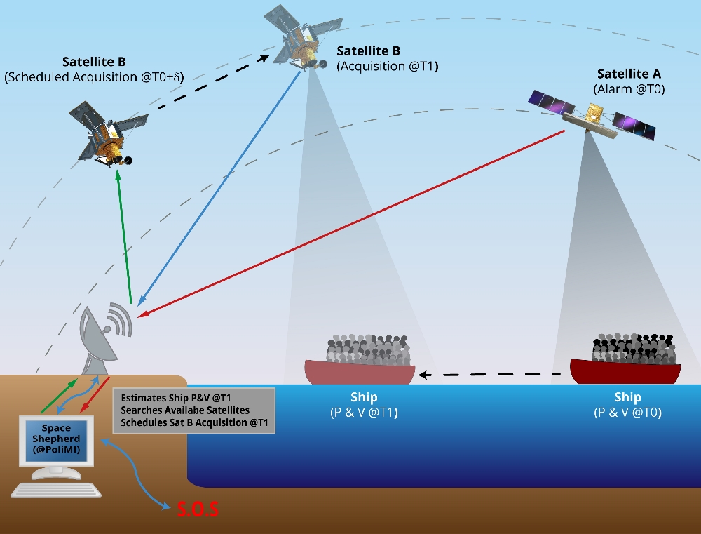
Outline of the “Space Shepherd” system.
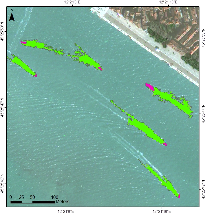
Automatic identification of vessels using very high-resolution satellite images: ships are in dark pink and wakes are in green. Data processing: Politecnico di Milano.